
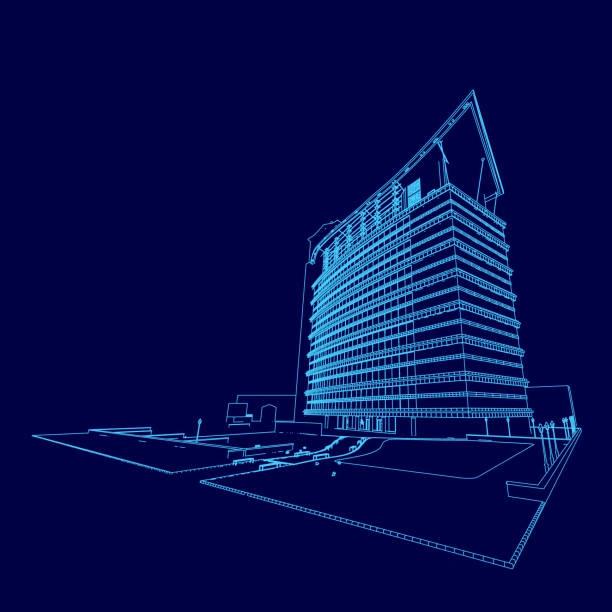
Training on BIM for Infrastructure Projects (Civil 3D & Infraworks)
Master BIM for infrastructure using Civil 3D and Infraworks. Model roads, bridges, and public works with geospatial data integration and advanced digital workflows.
Next intake
20 Jul 2026 · Nakuru
Duration
10 days
Live instruction
Delivery
Physical + Virtual
Cohort based
Level
Intermediate
Working professionals
Certification
NITA reimbursable
For Kenyan cohorts
Language
English
All materials
About this programme
This 10-day course is designed to equip civil engineering and infrastructure professionals with advanced knowledge and hands-on skills in applying BIM tools such as Autodesk Civil 3D and Infraworks. Participants will learn to model and manage infrastructure systems such as roads, highways, and bridges using geospatial data and BIM processes. With a focus on infrastructure modeling with Civil 3D, Infraworks for infrastructure planning, and geospatial data integration, this course empowers participants to plan, design, and deliver efficient and sustainable public works projects through collaborative digital workflows.
Duration
10 Days
Who Should Attend
-
Civil and Transportation Engineers
-
Infrastructure Project Managers
-
BIM Coordinators and CAD Technicians
-
Urban Planners and Land Surveyors
-
GIS and Geospatial Professionals
-
Public Works and Government Infrastructure Officers
What you'll walk away with
By the end of this course, participants will be able to:
-
Apply BIM methodologies to infrastructure projects including roads and bridges
-
Use Civil 3D for infrastructure modeling and site development
-
Utilize Infraworks for early-stage infrastructure planning and visualization
-
Integrate geospatial data for BIM infrastructure workflows
-
Collaborate across disciplines using cloud-based and open data standards
-
Optimize infrastructure project delivery using smart BIM processes
What we cover, module by module
Module 1: Introduction to BIM for Infrastructure
-
Key differences between vertical and horizontal BIM
-
Overview of BIM standards in infrastructure (ISO 19650, local mandates)
-
Benefits of BIM for roads and bridges projects
Module 2: Getting Started with Civil 3D for BIM
-
Setting up terrain, alignments, profiles, and corridors
-
Using Civil 3D for infrastructure modeling and grading
-
Pipe networks, utility layouts, and stormwater modeling
Module 3: Infraworks for Planning and Conceptual Design
-
Introduction to Infraworks for infrastructure planning
-
Importing and visualizing GIS, terrain, and CAD data
-
Conceptual roadway and bridge design workflows
Module 4: Advanced Corridor Modeling and Design Analysis
-
Creating and modifying complex corridor assemblies
-
Intersection and roundabout modeling
-
Quantity takeoffs and earthwork analysis
Module 5: Survey and Geospatial Data Integration
-
Integrating GIS and LiDAR data into BIM models
-
Geospatial data integration for BIM infrastructure
-
Using point clouds for terrain and asset mapping
Module 6: Environmental and Drainage Design with BIM
-
Surface water modeling and drainage systems
-
Stormwater and retention pond design in Civil 3D
-
Environmental impact analysis and mitigation modeling
Module 7: Bridges and Structures in BIM
-
Modeling bridges in Infraworks and importing into Revit/Civil 3D
-
Structural analysis integration
-
Visualization and clash detection of structural components
Module 8: Collaboration and Interoperability
-
Multi-disciplinary coordination using BIM 360 and Navisworks
-
Open BIM workflows and IFC exchange for infrastructure
-
Best practices for team collaboration and document control
Module 9: Visualization and Presentation of Infrastructure Projects
-
Creating compelling 3D presentations using Infraworks
-
Scenario simulation and alternative evaluation
-
Exporting models for stakeholder engagement and approvals
Module 10: Real-World Application and Project Review
-
Case studies: designing public works with BIM
-
Capstone project: plan and model a road/bridge using Civil 3D and Infraworks
-
Group presentation and feedback
Where the change lands
Organizational Impact
-
Improved efficiency in planning and delivering infrastructure projects.
-
Enhanced collaboration through integrated BIM and geospatial workflows.
-
Reduced project risks, errors, and rework.
-
Stronger capacity to deliver sustainable and future-ready infrastructure.
Personal Impact
-
Advanced expertise in Civil 3D and Infraworks for infrastructure design.
-
Career progression into senior engineering and BIM management roles.
-
Ability to deliver accurate, sustainable, and data-driven infrastructure projects.
-
Confidence to lead digital transformation in infrastructure development.
Dates and locations
Upcoming intakes
Every intake is limited to a small cohort. Booking closes when a date fills or three weeks before the start, whichever comes first.
| City | Starts | Ends | Delivery | Book |
|---|---|---|---|---|
NakuruNext | 20 Jul 2026 | 31 Jul 2026 | In-Person | Book |
Kigali | 20 Jul 2026 | 31 Jul 2026 | In-Person | Book |
Accra | 20 Jul 2026 | 31 Jul 2026 | In-Person | Book |
Kisumu | 27 Jul 2026 | 07 Aug 2026 | In-Person | Book |
Johannesburg | 27 Jul 2026 | 07 Aug 2026 | In-Person | Book |
Dakar | 27 Jul 2026 | 07 Aug 2026 | In-Person | Book |
- NakuruNext
20 Jul → 31 Jul·In-Person
Book this intake - Kigali
20 Jul → 31 Jul·In-Person
Book this intake - Accra
20 Jul → 31 Jul·In-Person
Book this intake - Kisumu
27 Jul → 07 Aug·In-Person
Book this intake - Johannesburg
27 Jul → 07 Aug·In-Person
Book this intake - Dakar
27 Jul → 07 Aug·In-Person
Book this intake
Common questions.
Still not sure? Send us a note and a facilitator will get back to you within a business day.
You may also like.
Programmes in the same discipline that participants often pair with this course.
 Hybrid5 days
Master advanced BIM techniques and elevate your building design and construction projects. Learn to leverage advanced BIM tools and workflows to optimize project delivery, improve collaboration, and reduce costs.
 Hybrid5 days
Master advanced construction techniques and elevate your building projects. Learn to utilize cutting-edge construction methods, innovative materials, and advanced technologies to improve efficiency, quality, and sustainability.
 Hybrid5 days
Understand structural engineering. This training gives you the fundamentals to use STAAD Pro for advanced design and data-driven decisions.
Course finder
Find the right course for you
Prefer to talk it through? Send us an enquiry and a facilitator will scope a fit within a business day.
For corporate teams
Training 10+ professionals?
We deliver Training on BIM for Infrastructure Projects (Civil 3D & Infraworks) in-house at your offices, at a venue we arrange, or fully virtual. Customise the curriculum against your KPIs, and get a bespoke price for the cohort size you need.