
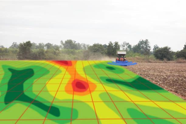
Training on Remote Sensing for Land Use and Land Cover Analysis
Master remote sensing for land use and land cover analysis. Learn to monitor land use changes, assess land cover patterns, and support sustainable land management.
Next intake
20 Jul 2026 · Nakuru
Duration
5 days
Live instruction
Delivery
Physical + Virtual
Cohort based
Level
Advanced
Working professionals
Certification
NITA reimbursable
For Kenyan cohorts
Language
English
All materials
About this programme
This course provides a comprehensive understanding of remote sensing techniques and their applications in land use and land cover (LULC) analysis. Participants will learn how to interpret and analyze satellite imagery to assess changes in land use, monitor environmental impacts, and support sustainable land management practices. The course combines theoretical concepts with hands-on exercises using remote sensing software, enabling participants to apply these techniques to real-world scenarios.
Course Duration
5 Days
Who Should Attend
- Environmental scientists and professionals
- GIS specialists and analysts
- Urban planners and land managers
- Researchers and academicians in geography, environmental studies, or related fields
- Government agencies and NGOs involved in land management and environmental monitoring
What you'll walk away with
By the end of this course, participants will be able to:
- Understand the fundamental principles of remote sensing and its role in LULC analysis.
- Interpret and analyze satellite imagery for land use classification and change detection.
- Utilize remote sensing software for processing and analyzing LULC data.
- Apply remote sensing techniques to monitor and manage environmental impacts and land use changes.
- Develop strategies for sustainable land management based on LULC analysis.
What we cover, module by module
Module 1: Foundations of Remote Sensing
- Introduction to remote sensing concepts and applications
- History and evolution of remote sensing technologies
- Principles of electromagnetic radiation and energy interaction with Earth surfaces
- Understanding the electromagnetic spectrum in remote sensing
- Types of remote sensing platforms: satellite, aerial, and drone-based systems
- Passive and active remote sensing systems
- Overview of major remote sensing satellites and sensors (Landsat, Sentinel, MODIS, etc.)
- Case Study: Monitoring environmental changes using satellite imagery in East Africa
- Practical Exercise: Exploring satellite imagery datasets and sensor characteristics using QGIS or Google Earth Engine
Module 2: Digital Image Processing and Interpretation
- Fundamentals of digital image processing
- Image preprocessing techniques: radiometric, atmospheric, and geometric correction
- Image enhancement methods for better visualization
- Band combinations, spectral signatures, and false color composites
- Introduction to image interpretation techniques
- Supervised and unsupervised image classification methods
- Object-Based Image Analysis (OBIA) concepts and workflows
- Case Study: Processing satellite images for vegetation analysis and urban mapping
- Practical Exercise: Performing image enhancement and classification using remote sensing software
Module 3: Land Use and Land Cover (LULC) Mapping
- Concepts and definitions of land use and land cover
- International LULC classification systems and standards
- Techniques for creating LULC maps from satellite imagery
- Factors influencing land cover changes
- Challenges in LULC analysis and classification accuracy
- Data collection and validation for LULC studies
- Case Study: Mapping land use changes in rapidly growing urban areas
- Practical Exercise: Creating a land use and land cover classification map from satellite data
Module 4: Remote Sensing Applications for Land Use and Land Cover Analysis
- Selecting appropriate remote sensing datasets for LULC analysis
- Multi-temporal image analysis for change detection
- Accuracy assessment and validation of LULC maps
- GIS integration for advanced spatial analysis
- Monitoring environmental and socio-economic changes using remote sensing
- Spatial modeling and predictive analysis for land use planning
- Case Study: Detecting deforestation trends using Landsat imagery over a 10-year period
- Practical Exercise: Conducting land cover change detection and accuracy assessment using GIS and remote sensing tools
Module 5: Environmental and Natural Resource Applications of Remote Sensing
- Remote sensing for forest and biodiversity monitoring
- Agricultural land assessment and crop monitoring
- Water resource and watershed management applications
- Urban growth and infrastructure development analysis
- Disaster risk management and emergency response mapping
- Climate change monitoring and environmental impact assessment
- Emerging trends: drones, AI, and cloud-based remote sensing platforms
- Case Study: Using remote sensing for flood monitoring and disaster response planning
- Practical Exercise: Developing a remote sensing project for environmental monitoring and presenting findings using maps and visual reports
Where the change lands
Organisational Impact
-
Strengthens capacity to monitor and assess land use changes for planning and policy development.
-
Supports sustainable land management by providing accurate data for decision-making.
-
Enhances ability to track environmental impacts such as deforestation, urban growth, and agricultural expansion.
-
Reduces reliance on costly field surveys through the use of satellite imagery and remote sensing tools.
-
Builds institutional expertise in integrating LULC analysis into environmental and development programs.
Personal Impact
-
Equips participants with practical skills to interpret and analyze satellite imagery for LULC applications.
-
Expands career opportunities in environmental management, GIS, urban planning, and research.
-
Builds confidence in using remote sensing software to assess land use patterns and changes.
-
Provides hands-on experience with real-world datasets and case studies.
-
Empowers participants to contribute effectively to sustainable land management and environmental conservation initiatives.
Dates and locations
Upcoming intakes
Every intake is limited to a small cohort. Booking closes when a date fills or three weeks before the start, whichever comes first.
| City | Starts | Ends | Delivery | Book |
|---|---|---|---|---|
NakuruNext | 20 Jul 2026 | 24 Jul 2026 | In-Person | Book |
Kigali | 20 Jul 2026 | 24 Jul 2026 | In-Person | Book |
Accra | 20 Jul 2026 | 24 Jul 2026 | In-Person | Book |
Kisumu | 27 Jul 2026 | 31 Jul 2026 | In-Person | Book |
Johannesburg | 27 Jul 2026 | 31 Jul 2026 | In-Person | Book |
Dakar | 27 Jul 2026 | 31 Jul 2026 | In-Person | Book |
- NakuruNext
20 Jul → 24 Jul·In-Person
Book this intake - Kigali
20 Jul → 24 Jul·In-Person
Book this intake - Accra
20 Jul → 24 Jul·In-Person
Book this intake - Kisumu
27 Jul → 31 Jul·In-Person
Book this intake - Johannesburg
27 Jul → 31 Jul·In-Person
Book this intake - Dakar
27 Jul → 31 Jul·In-Person
Book this intake
Common questions.
Still not sure? Send us a note and a facilitator will get back to you within a business day.
You may also like.
Programmes in the same discipline that participants often pair with this course.
 Hybrid10 days
Learn AI and computer vision for urban growth monitoring and informal settlement mapping using satellite imagery, GIS, deep learning, and spatial analytics.
 Hybrid10 days
Learn AI-powered disaster damage assessment using satellite imagery, machine learning, GIS, and remote sensing for rapid response and recovery planning.
 Hybrid10 days
Learn AI-powered water body and flood extent mapping using SAR data, machine learning, GIS, and remote sensing for disaster management and water resources.
Course finder
Find the right course for you
Prefer to talk it through? Send us an enquiry and a facilitator will scope a fit within a business day.
For corporate teams
Training 10+ professionals?
We deliver Training on Remote Sensing for Land Use and Land Cover Analysis in-house at your offices, at a venue we arrange, or fully virtual. Customise the curriculum against your KPIs, and get a bespoke price for the cohort size you need.