
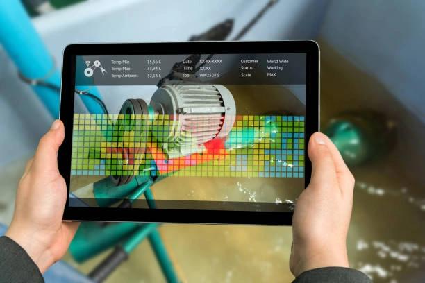
Training on Digital Tools for WASH Data Collection and Monitoring
Master GIS, mobile tools, and remote sensing to enhance WASH planning and monitoring. Build capacity in mapping, data collection, and digital decision support for WASH programs.
Next intake
20 Jul 2026 · Nakuru
Duration
5 days
Live instruction
Delivery
Physical + Virtual
Cohort based
Level
Intermediate
Working professionals
Certification
NITA reimbursable
For Kenyan cohorts
Language
English
All materials
About this programme
This course equips WASH professionals with practical skills in GIS, mobile data collection, remote sensing, and digital mapping for effective WASH planning and service delivery. Participants will learn how to map water and sanitation infrastructure, collect and analyze real-time field data, monitor WASH programs, and support evidence-based decision-making using geospatial technologies. The training combines practical exercises, digital tool applications, and real-world case studies relevant to humanitarian, development, and public sector WASH operations.
Duration
5 Days
Who Should Attend
-
WASH Officers and Engineers
-
Monitoring & Evaluation Specialists
-
GIS and Data Analysts
-
Humanitarian and Development Practitioners
-
Environmental Health Professionals
-
Government Planners and Technicians
-
NGO and UN Agency Program Staff
What you'll walk away with
By the end of this course, participants will be able to:
-
Understand the role of digital tools in WASH programming
-
Use GIS for mapping WASH infrastructure and services
-
Conduct mobile-based WASH assessments and surveys
-
Apply remote sensing techniques for water and sanitation monitoring
-
Visualize and analyze spatial WASH data for evidence-based decisions
-
Develop custom dashboards for WASH program reporting
-
Integrate digital monitoring into routine WASH planning and evaluations
What we cover, module by module
Module 1: Foundations of Digital WASH Monitoring and GIS
- Introduction to WASH monitoring systems and key performance indicators
- Overview of GIS, mobile data collection, and remote sensing technologies
- Role of digital tools in WASH planning, implementation, and reporting
- Benefits and challenges of technology-driven WASH operations
- Case Study: GIS adoption in national WASH monitoring programs
- Practical: Explore digital mapping tools for WASH service monitoring
Module 2: GIS Mapping and Mobile Data Collection for WASH
- Fundamentals of GIS and spatial data management for WASH
- Mapping water supply, sanitation, and hygiene infrastructure
- Designing digital surveys using KoboToolbox, ODK, and SurveyCTO
- Conducting field data collection using mobile devices
- Case Study: Mobile-based WASH assessments in humanitarian settings
- Practical: Create a WASH infrastructure map and mobile data collection form
Module 3: Remote Sensing and Real-Time WASH Monitoring
- Introduction to remote sensing and satellite imagery for WASH analysis
- Monitoring water resources, floods, and environmental risks using geospatial tools
- Integrating GIS, remote sensing, and mobile data into dashboards
- Developing early warning and real-time monitoring systems for WASH services
- Case Study: Remote sensing applications in drought and flood response programs
- Practical: Analyze satellite data for WASH risk monitoring and reporting
Module 4: Data Visualization, Governance, and Community Engagement
- Data cleaning, validation, and quality assurance techniques
- Creating dashboards and visual reports using Power BI and GIS platforms
- Ethical considerations, data protection, and responsible digital data use
- Participatory mapping and community engagement approaches in WASH monitoring
- Case Study: Community-led digital WASH mapping initiatives
- Practical: Build a WASH dashboard and visualize service delivery data
Module 5: Designing and Implementing Digital WASH Monitoring Systems
- Planning and implementing digital WASH monitoring and evaluation systems
- Selecting appropriate technologies for development and humanitarian programs
- Resource planning, interoperability, and sustainability considerations
- Organizational action planning for digital transformation in WASH
- Case Study: Successful implementation of integrated digital WASH monitoring systems
- Final Project: Develop a technology-driven WASH monitoring and reporting framework for a real or simulated project
Where the change lands
Organizational Impact
-
Improves accuracy and timeliness of WASH data for better decision-making.
-
Increases operational efficiency by reducing manual data collection and analysis.
-
Enhances organizational credibility as a leader in evidence-based development.
Personal Impact
-
Builds in-demand skills for careers in development and humanitarian sectors.
-
Supports progression to senior M&E, leadership, or advisory roles.
-
Empowers participants to lead innovative data collection and monitoring initiatives.
Dates and locations
Upcoming intakes
Every intake is limited to a small cohort. Booking closes when a date fills or three weeks before the start, whichever comes first.
| City | Starts | Ends | Delivery | Book |
|---|---|---|---|---|
NakuruNext | 20 Jul 2026 | 24 Jul 2026 | In-Person | Book |
Kigali | 20 Jul 2026 | 24 Jul 2026 | In-Person | Book |
Accra | 20 Jul 2026 | 24 Jul 2026 | In-Person | Book |
Kisumu | 27 Jul 2026 | 31 Jul 2026 | In-Person | Book |
Johannesburg | 27 Jul 2026 | 31 Jul 2026 | In-Person | Book |
Dakar | 27 Jul 2026 | 31 Jul 2026 | In-Person | Book |
- NakuruNext
20 Jul → 24 Jul·In-Person
Book this intake - Kigali
20 Jul → 24 Jul·In-Person
Book this intake - Accra
20 Jul → 24 Jul·In-Person
Book this intake - Kisumu
27 Jul → 31 Jul·In-Person
Book this intake - Johannesburg
27 Jul → 31 Jul·In-Person
Book this intake - Dakar
27 Jul → 31 Jul·In-Person
Book this intake
Common questions.
Still not sure? Send us a note and a facilitator will get back to you within a business day.
You may also like.
Programmes in the same discipline that participants often pair with this course.
 Hybrid5 days
Learn how AI, satellite imagery, and remote sensing technologies support drought monitoring and water scarcity forecasting.
 Hybrid5 days
Build expertise in AI-driven water resource planning to strengthen water security, resilience, and climate adaptation.
 Hybrid5 days
Learn AI-powered groundwater and aquifer sustainability modeling using machine learning, GIS and geospatial analytics for water resource planning and management
Course finder
Find the right course for you
Prefer to talk it through? Send us an enquiry and a facilitator will scope a fit within a business day.
For corporate teams
Training 10+ professionals?
We deliver Training on Digital Tools for WASH Data Collection and Monitoring in-house at your offices, at a venue we arrange, or fully virtual. Customise the curriculum against your KPIs, and get a bespoke price for the cohort size you need.